Considering Deer Surveys Using Drones?
Estimating the number of white-tailed deer using an area is a key part of deer management. After all, it’s important to know what’s out there before the trigger pulling starts. Conducting deer surveys using drones has gained interest in recent years as another way to estimate whitetail populations. However, can drone deer surveys provide useful information?
Managers often use one or more survey methods to estimate their deer herd annually. The survey methods traditionally use are not perfect. Over the years, research has found standard survey methods are far from infallible. More recently, many started using camera surveys for deer. However, there’s always another (and possibly) a better way. In the last few years, interest in conducting deer surveys using drones is trending up.
The article below discusses using drones to survey deer and was part of a recent ENEWS blast from Caesar Kleberg Wildlife Research Institute:

Can We Count Deer Using Drones?
- by Aaron Foley, Jesse Exum, and Randy DeYoung
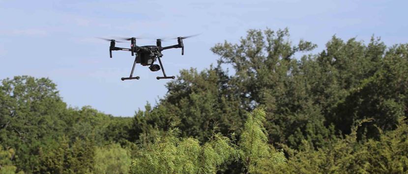
“White-tailed deer are often managed for recreational harvest. Deer managers need a way to estimate the number of deer to track population size relative to management goals. Methods for counting deer include spotlight, helicopter, and trail camera surveys. All are useful, but each method has its own strengths and weaknesses. Recently, unmanned aircraft systems, or drones, have become widely available. As the capabilities of drones continue to grow, so does the interest in use of drones for wildlife surveys.
To evaluate a new survey method, one needs to understand what percent of the population is counted, how much counts vary in repeated surveys, and how the counts compare with other survey methods. Jesse Exum took on the challenge of developing drone survey methods and evaluating their effectiveness as part of her graduate research at CKWRI. Jesse flew repeated drone surveys for deer on two South Texas properties (250 acres and 1,000 acres).
One of the first insights was that drone surveys were much better when done with a thermal video camera, which detects animals by the difference between their body heat and the surrounding vegetation. The regular video camera did a poor job of detecting deer in part because deer did not react to the drone. During helicopter surveys, most deer run away and it is easier to see a moving animal than a stationary one.
The next step was to determine what percent of deer present were counted during a drone survey. Wildlife surveys rarely count 100% of animals; deer may be obscured by brush. If we know the percent counted and why some deer are not counted, we can use statistical methods to adjust the count to obtain a more accurate estimate of population size. We found that drone surveys counted 56-64% of deer on both properties. We observed more deer closer to the drone flight path and fewer farther away. This tells us that deer visibility becomes obscured by vegetation farther from the flight line. Fortunately, there are statistical methods to account for the missed deer due to this visibility bias.
The next steps were to generate population estimates after accounting for visibility, then determine consistency in repeated counts on the same site. Repeated population estimates ranged from 2.7–4.0 acres/deer on the 250-acre property and 7.4–10.9 acres/deer on the 1,000-acre property. Additionally, our consistent drone-based population estimates suggest one can get a reliable count from a single survey.
The last step was to determine how the drone estimates compared with other survey methods. On the 1,000-acre property, the helicopter, baited trail camera, and drone surveys all resulted in similar population estimates (8.2–8.9 acres/deer). On the 250-acre property, spotlight counts (4.3 acres/deer) and drone surveys (2.7–4.0 acres/deer) were comparable. The finding that drone counts were similar to other survey methods indicates that drones are a good alternative survey method for deer.
Overall, we found that drones are a promising new tool to the deer manager’s toolbox. However, additional work is needed to address some of the weaknesses of the drone surveys. We cannot easily tell whether a deer is a buck, doe, or fawn on the thermal footage; it can also be difficult to separate deer and some species of exotics.
We also need to understand how visibility changes in different habitat types. Both properties we surveyed were mainly brush; thus, additional investigation is needed for areas that contain grassland or trees. We are already working on several of these issues in follow-up studies and will continue to provide updates.”
Verdict: Deer Surveys Using Drones
Drone surveys conducted by researchers at CKWRI estimated deer populations similar to other survey methods. This means drones provide information that is as good as other deer survey techniques on these study sites. So the deer management toolbox now contains drones. That’s a good thing. It’s always good to have options since not every tool works for every job. Different ways to estimate deer populations exist for a reason.
Do drones make since in every situation? Obviously, no. Deer surveys using drones in South Texas make since. Most of the woody cover consist of relatively short brush. Because of this, mangers commonly conduct aerial surveys for deer using helicopters in the region. The use of drones is another option for managers in South Texas, areas with similar woody plant structure, and properties lacking dense canopy cover. The best deer survey method for a property is one that provides good, reliable data.
Thank you for the information on drones. We’ve been thinking about using them on our ranch in western hill country.